Miami Public Transit & Walkability by Neighborhood (2026 Guide)
By Rangely Adames • April 2026 • 9 min read
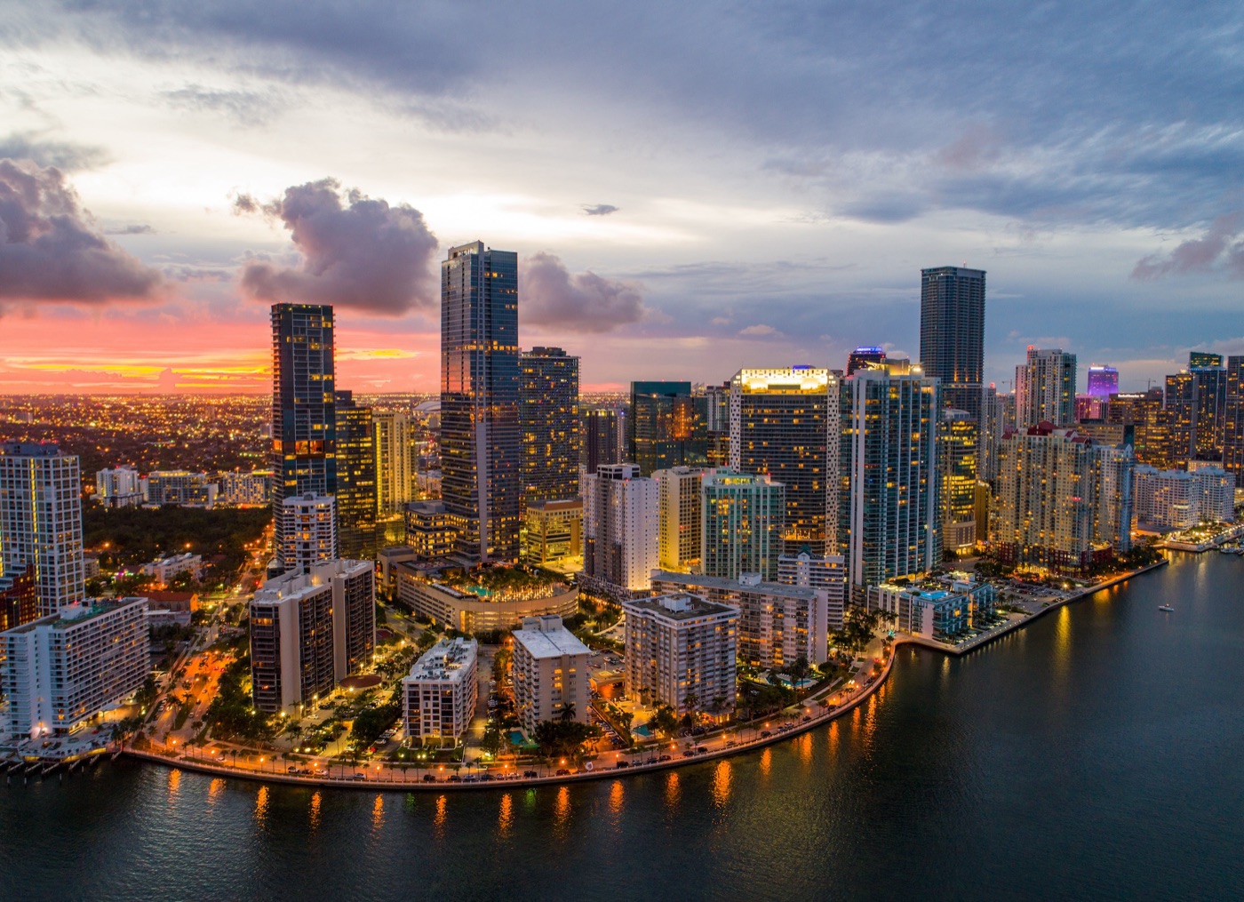
Miami has long been known as a car-dependent city, but that reputation is changing. With ongoing transit expansions, new bike infrastructure, and increasingly dense walkable neighborhoods, more Miami residents are finding they can reduce or even eliminate their reliance on a car. For buyers, transit access and walkability are becoming significant factors in property values and quality of life. La accesibilidad de transporte publico esta transformando como vivimos en Miami, y las propiedades cerca del transito estan ganando valor.
Miami's Transit System Overview
Miami-Dade Transit operates three rail systems plus an extensive bus network. Metrorail is the elevated heavy rail line running 25 miles from Dadeland South to Palmetto, with a spur to Miami International Airport. Metromover is a free automated people mover circulating through downtown Miami and Brickell. Tri-Rail is the commuter rail connecting Miami to Fort Lauderdale and West Palm Beach. Together, these systems serve the urban core well but have limited reach into the suburbs.
The Brightline high-speed rail, connecting Miami to Fort Lauderdale, West Palm Beach, and Orlando, adds another layer of regional connectivity. MiamiCentral station in downtown is a major hub that has spurred residential and commercial development in the surrounding blocks.
Explore on rangelyadames.com
Most Walkable Neighborhoods
Brickell (Walk Score: 93)
Brickell is Miami's most walkable neighborhood and one of the most transit-accessible. With the free Metromover, Metrorail stations at Brickell and Vizcaya, and thousands of restaurants, shops, and services within walking distance, many Brickell residents go weeks without using a car. The density of high-rise residential towers means everything you need is within a 10-minute walk. Condos range from $350,000 to $2 million-plus. Explore Brickell.
Downtown Miami (Walk Score: 89)
Downtown is the transit hub of Miami-Dade County. Government Center station connects Metrorail and Metromover, Brightline runs from MiamiCentral, and dozens of bus routes converge here. The neighborhood has seen massive residential growth with new towers offering units from $300,000 to $1.5 million. The walkability is strong for daily errands, dining, and entertainment, though some blocks still feel more commercial than residential.
South Beach (Walk Score: 91)
South Beach is extremely walkable within its own boundaries, with a compact grid that puts everything from groceries to beaches to nightlife within a short walk or bike ride. However, transit connections to the mainland are limited to buses across the MacArthur and Julia Tuttle causeways. A car remains useful for leaving the Beach. Condos from $250,000 to $5 million-plus.
Coconut Grove (Walk Score: 73)
The Grove's village center around CocoWalk is highly walkable, and the Coconut Grove Metrorail station provides rail access to downtown and Dadeland. The residential streets beyond the village core are more car-dependent, but the community has invested in bike lanes and pedestrian improvements. Explore Coconut Grove.
Consejo: Neighborhoods Along the Metrorail Corridor
Properties within a half-mile of Metrorail stations consistently command a premium of 5-15% over comparable properties farther from transit. The stations at Dadeland South, Dadeland North, Douglas Road, Coconut Grove, Vizcaya, Brickell, and Government Center all anchor neighborhoods with strong real estate demand. Comprar cerca del Metrorail no solo te da conveniencia, tambien protege tu inversion porque la demanda cerca del transito sigue creciendo.
The Dadeland area in particular offers an excellent combination of transit access (two Metrorail stations), walkable retail at Dadeland Mall, and a range of condo options from $250,000 to $800,000. Search transit-accessible properties on our MLS search.

Bike-Friendly Areas
Miami has expanded its bike infrastructure significantly, and several neighborhoods are now genuinely bikeable. Miami Beach has dedicated bike lanes along most major streets and the Beachwalk path. Brickell and Downtown have Citi Bike stations on nearly every block. Coral Gables has scenic, shaded routes through residential streets. The Underline, a 10-mile linear park beneath the Metrorail from Brickell to Dadeland, has created a dedicated bike and pedestrian corridor that connects multiple neighborhoods.
For more on outdoor living and active transportation, see our outdoor lifestyle guide.
En Espanol: Transporte Publico en Miami
Miami esta mejorando su sistema de transporte publico, y cada vez mas vecindarios permiten vivir sin depender tanto del carro. Si te interesa reducir tus gastos de transporte o simplemente caminar mas, enfocate en Brickell, Downtown, Coconut Grove, o las zonas cerca del Metrorail. Las propiedades cerca del transito publico no solo son mas convenientes, tambien tienden a mantener su valor mejor que las que estan lejos.
Future Transit Projects to Watch
Miami-Dade is planning significant transit expansions that will reshape the real estate landscape. The proposed East-West corridor connecting Miami Beach to the mainland via rail or bus rapid transit would dramatically improve Beach-to-downtown connectivity. The North Corridor extension of Metrorail toward Aventura and the proposed South Corridor to Florida City would open new transit-accessible neighborhoods. Buying ahead of these improvements can be a smart investment strategy.
Whether you prioritize walkability, transit, or both, I can help you find the right neighborhood. Browse current listings or visit our rentals page if you want to test a neighborhood before committing. For more buyer information, see our buyer's guide.
Related Articles
February 2026 · 9 min read
Aventura Real Estate Guide: Condos, Schools & Lifestyle (2026)
Luxury high-rises, top-rated schools, and the Aventura Mall — why families and investors love this North Miami suburb.
Read article →February 2026 · 9 min read
Airbnb Investment Properties in Miami: Rules, ROI & Best Areas
Short-term rental regulations, income projections, and the best Miami neighborhoods for Airbnb investing.
Read article →July 2026 · 10 min read
Brickell City Centre Area Guide: Living, Dining & Real Estate (2026)
A complete bilingual guide to the Brickell City Centre area: the best condo buildings, dining, shopping, walkability, and 2026 prices. Everything you need before buying. Hablamos Espanol.
Read article →Want to Live Car-Optional in Miami?
I'll help you find walkable, transit-connected properties in Miami's most convenient neighborhoods.